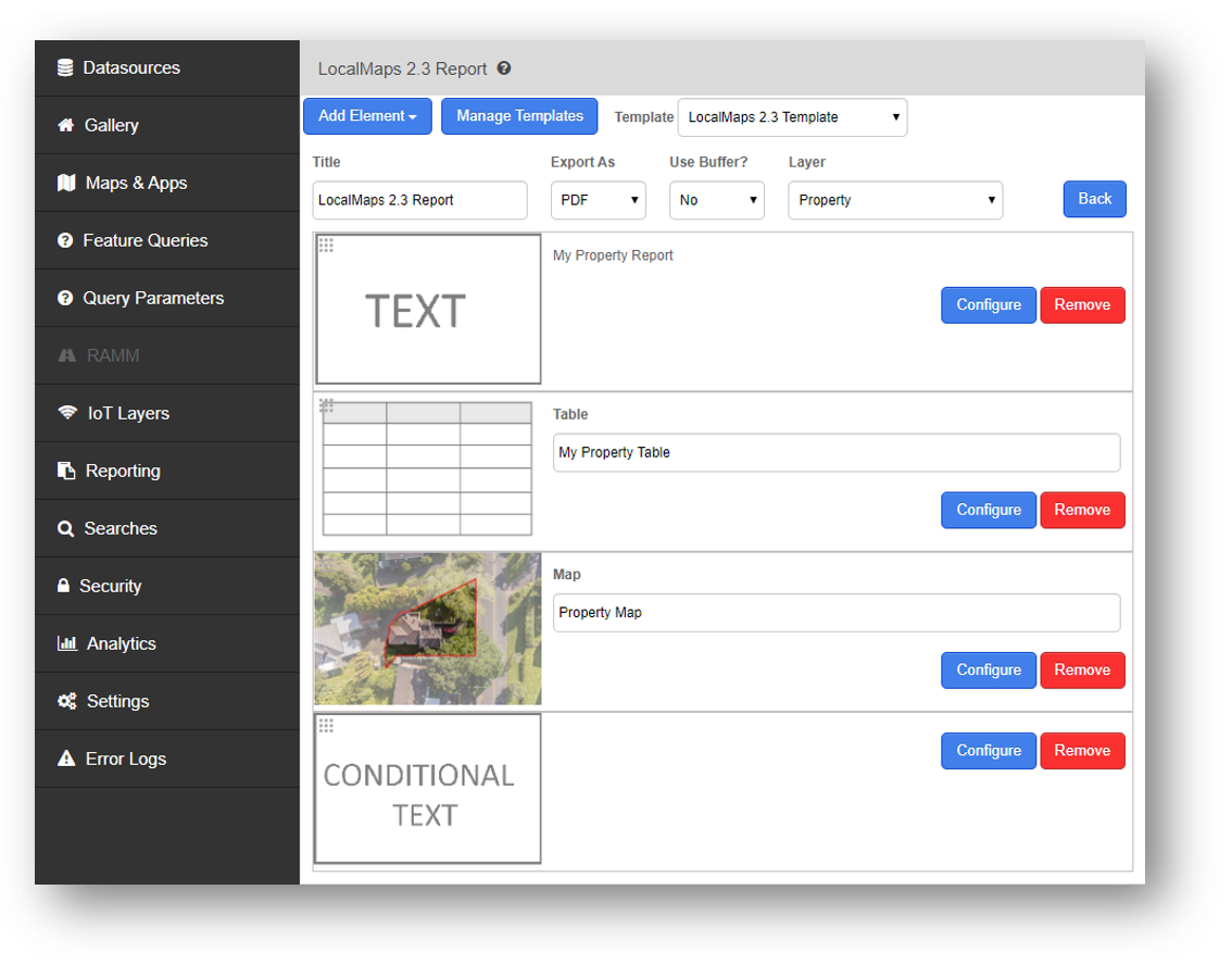
LocalMaps Reports are a powerful tool which allow you to bring together multiple maps, tables and text elements to form one cohesive report.
The data that you reference in a LocalMaps report could be from an on-the-fly spatial query against the feature or reading directly from your databases. LocalMaps provides you with a default report template but you can also create your own and upload it to use. Once created, reports can be added to one map or multiple maps so long as they contain the appropriate layer the report was set up against. You also have the option to combine reports and build conditional reports based on whether a feature intersects with any range of other layers.
In this section:
Email LocalMaps Support to ask a question or request assistance.